


Go West - The Wild West Coast
Words and images by Dave Mitchell
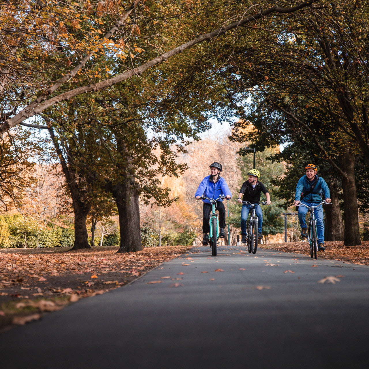
The old Ghost road is a great track, diverse and high quality. The track ends have been joined and you can also ride it as a loop track. Read up on this 3 day adventure on the West Coast.
In 1862, a party of Maori prospectors discovered the first gold in Lyell Creek, and the rush was on. At its peak, the town of Lyell boasted seven stores, five hotels, two churches, a school, bank, post office, police station, mining office and of course a brewery. None remain. The Lyell cemetery and all the old mining relics, tunnels and water races are all that survived, along with an old dray road which winds its way above Lyell Creek, to the Lyell Saddle.
Forward 150 years: a group of track building nutters, all worthy of mountain biking’s greatest accolades and honours, launched the Mokihininui-Lyell Backcountry Trust - completing what the miners failed to do when the gold ran out.
The volunteer work scheme each summer has been over-subscribed, and the volume and quality of the track reflects their commitment and passion. The track ends have now been joined.
Old Ghost Road - Day One
Lyell to Specimen Creek Hut: 7 hours, 65km, Grade 3&4
100% single track
Just 30km from Murchison, the old Lyell town site deep in the upper Buller Gorge, has become a great DOC campground. There are plenty of lodging and food options in Murchison, and it’s close enough to make an early start on the track.
From camp, we immediately crossed the first of many impressive swing bridges, to the old restored dray road towards the Lyell Saddle and Hut. The track passes through many old mining claims and settlements, with rusting relics and stone walls all that remain.
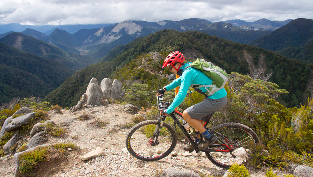
We refuelled on the deck in front of the cosy Lyell Saddle hut, taking in the view down the Mokihinui River South Branch. From the saddle, we climbed a series of sweeping zig zags onto the main ridge, before heading towards the tops: uninterrupted views across to 1000 Acre Plateau, Mt Owen, the Glasgow Range and boundless ocean.
After a short carry section, we were back on the track and heading down to Ghost Lake Hut - a great place to break the trip in two, and enjoy a night on the tops.
The track down from Ghost Lake Hut is tight and technical, with a few more carry sections to Stern Hut. From there, the newly-minted trail continues out to historic Goat Hut, and across a massive swing bridge, which spans the Mokihinui River South Branch.
Flowing single track weaves its way through tall forest, to the renovated Mokihinui Forks Hut, and out to the newly built Specimen Creek Hut - perched high above where the river and track head west. This would also be a great place to end up on Day One: relax on the deck, maybe some fishing before sunset.

Day Two
Specimen Creek Hut to Ngakawau: 45km, Grade 3, 5 hours
75% Single Track, 20% Gravel, 5% Sealed
The river has cut a narrow channel between the convoluted base of the Radiant, and Glasgow Ranges. The original old miners' benched track was cut by hand, high above the river - forming the perfect base for the Old Ghost Road out to Seddonville.
With views to die for, we rode carefully around the more exposed sections -admiring the river and spectacular gorge below. Three new swing bridges span steep rock faces, then the track relaxes for the final section out to the track end at Rough and Tumble Creek. A lodge by the same name beside the final ford, offers palatial accommodation for the weary mountain biker, catering for groups of 2- 20.
Down the road in Seddonville, there’s a Hotel and motor camp, and a motor camp on either side of the Mokihinui River, just as it enters the Tasman (handy to know, as the area is very popular during the whitebait season).

Charming Creek Rail Trail to Ngakawau
In Seddonville, go right at the tavern, and onto Mill Creek Road. Beyond the town limits a loose gravel road undulates through pine and regenerating native bush forest for 9km, to the old Charming Creek Coal Mine, and DOC sign-posted track end.
Red, rusty mine relics surround the mine site. Old coal bins have collapsed, but a roofless concrete building remains standing. The original railway finished at the mine and not far down the line is the first tunnel.
Steel track disappears inside, as a bypass route heads through the surrounding bush to rejoin the tracks on the other side of a small hill. The grade is, as you would expect from a railway, flat and slightly downhill with big wide curves.
From the last mill site the track narrows - hugging the cliff face way above the river, and becoming a challenging ride. At the turn of the gorge where Charming Creek and the Ngakawau River meet, a tunnel heads into darkness. It delivers you out into the Ngakawau Gorge proper, across from a massive waterfall. Just below the waterfall, a high swing bridge gives a great view of the massive, house-sized rocks strewn down the length of the riverbed. The gorge is very steep, narrow and rugged.
There’s a final rail tunnel just before the track splits, with a sidetrack to an abandoned tractor loco. The main track heads east to Crane Cliff and a large clearing where workshops and coal sorting bins once stood. The main track ironically exits past two 30 cwt coal trucks at the modern railhead of the Stockton Mine, and into the town of Ngakawau - where the Charming Creek Tavern offers food and accommodation: www.charmingcreektavern.co.nz/
There’s also a shop and some local B&B’s, with more choices further down the road at Granity - including an excellent café, Drifters.

Day Three
Ngakawau to Lyell: 60km, Grade 3, 7 hours
Sealed 40%, Gravel 20%, 4WD 40%
The coast road makes for a leisurely ride south to Waimangaroa. It looked a bit dejected - in need of paint and a good coffee or café, as we rode on through to attack the road climb up to Denniston. A relaxing grade of tar seal delivers ever-expanding views through regenerating beech forest, manuka and stunted shrubbery to Denniston Town.
Deleted from Manual- The signs of large-scale coal mining are slowly fading, with roads and relics getting swallowed by gorse and native regeneration. The town was asleep or missing, with the few remaining corrugated iron clad homes wrapped in acrylic paint… No coal smoke exiting their blackened chimneys, and lots of spare chimneys with no dwelling attached.
At its peak, Denniston boasted a population of 1500, but the Great Depression, and subsequent decision to opencast mine Stockton, saw the majority of the miners disappear by 1995. Today there are just a handful of houses left, and a great little museum to wander through. For mountain bikers, there’s a vast array of tracks of all shapes and sizes on the plateau and beyond.
From Denniston, head south on Burnett’s Face Road to Burnett’s Face. The gravel road continues east to Burning Mine through steep country strewn with massive rock outcrops.
The track follows the top end of the Waimangaroa River into regenerating native bush, between two rows of power pylons. An intersection appears just after you cross Cedar Creek. The north branch takes you past a group of abandoned coal-mines but loops back onto the main track. The east track heads up onto the Mt William Range following the southern- most pylons, but at the next intersection, it’s critical to go north heading for the northern pylons. The straight-ahead track is a downhill dead end but has great views.
You’ll join the loop track at the next intersection - head east following the northern pylons through patches of mature beech forest, down to the main river crossing at the Mackley or Orikaka River. Be warned: even after moderate rainfall, this river can be dangerous to cross. The descent is steep and gnarly with deep ruts, and is boulder-strewn in places.
You exit the ford onto an old forestry road, which climbs up to the ridge-top, to yet another intersection. Keep going east - the southern track heads back to the Orikaka and a dead end.
The main track undulates to Coal Flat with a surprising amount of climbing and descending - through cut-over bush, and past a number of old mine workings being swallowed by regeneration. There’re signs of recent coal mining activity in this area, including a gigantic set of coal bins nearing the end of the track.
You reach Pensini Creek and follow it through a piece of farm land, onto a sealed, then gravel road which heads out to New Creek and the main Buller Gorge road, at the old Iron Bridge. Hang a left (or you’ll end up in Westport), for the short final push back up the gorge to Lyell. You’ve completed the loop.

Nitty Gritty - Old Ghost Road:
Start - Lyell Historic Reserve
Finish - Mokihinui Gorge
Distance - 84 km
Difficulty - Advanced
Level of Fitness - Moderate
Duration - 2-3 days
Trail Type - Dual Use
Useful Resources
oldghostroad.org.nz